


UPPER TYRONE Voting District, Fayette County, Pennsylvania
About
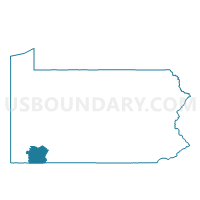
Outline

Summary
| Unique Area Identifier | 659731 |
| Name | UPPER TYRONE Voting District |
| County | Fayette County |
| State | Pennsylvania |
| Area (square miles) | 7.82 |
| Land Area (square miles) | 7.80 |
| Water Area (square miles) | 0.02 |
| % of Land Area | 99.73 |
| % of Water Area | 0.27 |
| Latitude of the Internal Point | 40.07818900 |
| Longtitude of the Internal Point | -79.59460140 |
Maps


Graphs
Select a template below for downloading or customizing gragh for UPPER TYRONE Voting District, Fayette County, Pennsylvania


Neighbors
Neighoring Voting District (by Name) Neighboring Voting District on the Map
- BULLSKIN TWP DIST 01, Fayette County, PA
- BULLSKIN TWP DIST 02, Fayette County, PA
- CONNELLSVILLE TWP Voting District, Fayette County, PA
- DUNBAR TWP DIST 03, Fayette County, PA
- EAST HUNTINGDON TWP VTD BESSEMER ED 02, Westmoreland County, PA
- EAST HUNTINGDON TWP VTD WHITES, Westmoreland County, PA
- EVERSON Voting District, Fayette County, PA
- LOWER TYRONE TWP Voting District, Fayette County, PA
- SCOTTDALE WD 01, Westmoreland County, PA
- SCOTTDALE WD 03, Westmoreland County, PA
- SCOTTDALE WD 04, Westmoreland County, PA
Top 10 Neighboring County Subdivision (by Population) Neighboring County Subdivision on the Map
- East Huntingdon township, Westmoreland County, PA (7,963)
- Dunbar township, Fayette County, PA (7,126)
- Bullskin township, Fayette County, PA (6,966)
- Scottdale borough, Westmoreland County, PA (4,384)
- Connellsville township, Fayette County, PA (2,391)
- Upper Tyrone township, Fayette County, PA (2,059)
- Lower Tyrone township, Fayette County, PA (1,123)
- Everson borough, Fayette County, PA (793)
Top 10 Neighboring Place (by Population) Neighboring Place on the Map
Top 10 Neighboring Unified School District (by Population) Neighboring Unified School District on the Map
- Connellsville Area School District, PA (34,494)
- Southmoreland School District, PA (15,199)
- Frazier School District, PA (8,015)
Top 10 Neighboring State Legislative District Lower Chamber (by Population) Neighboring State Legislative District Lower Chamber on the Map
- State House District 59, PA (61,834)
- State House District 58, PA (59,656)
- State House District 52, PA (56,814)
- State House District 51, PA (56,731)
Top 10 Neighboring State Legislative District Upper Chamber (by Population) Neighboring State Legislative District Upper Chamber on the Map
Top 10 Neighboring 111th Congressional District (by Population) Neighboring 111th Congressional District on the Map
- Congressional District 9, PA (666,810)
- Congressional District 18, PA (653,385)
- Congressional District 12, PA (612,384)
Top 10 Neighboring Census Tract (by Population) Neighboring Census Tract on the Map
- Census Tract 8065, Westmoreland County, PA (4,783)
- Census Tract 2609, Fayette County, PA (4,558)
- Census Tract 2606, Fayette County, PA (4,306)
- Census Tract 2603, Fayette County, PA (3,798)
- Census Tract 8064, Westmoreland County, PA (2,402)
- Census Tract 2604.01, Fayette County, PA (2,393)
- Census Tract 8063, Westmoreland County, PA (1,982)
- Census Tract 2633, Fayette County, PA (1,630)